GPS Map Camera
Virus free
- Updated: 11.07.26
- Version: 1.9.24
- Requires: Android 6.0 and up
- Google Play: Open

Modern technologies make our lives more convenient and travel more interesting. One such tool is an Android app called GPS Map Camera. This app allows you to take photos with the exact location, date and time taken, which is especially useful for travelers, tourists and professionals who need accurate documentation of their routes.
Description
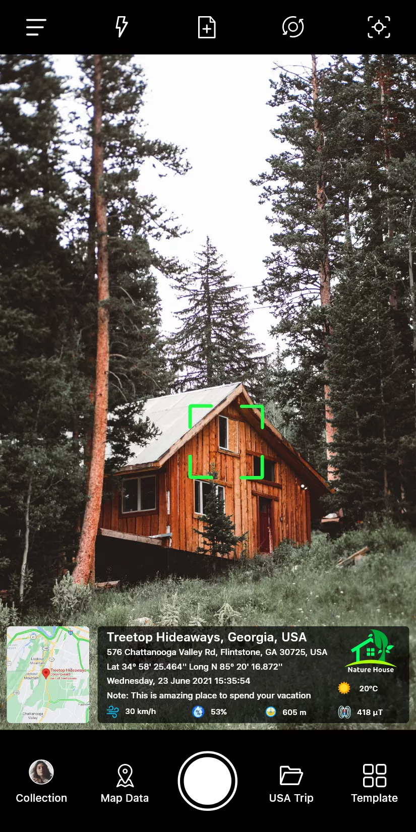
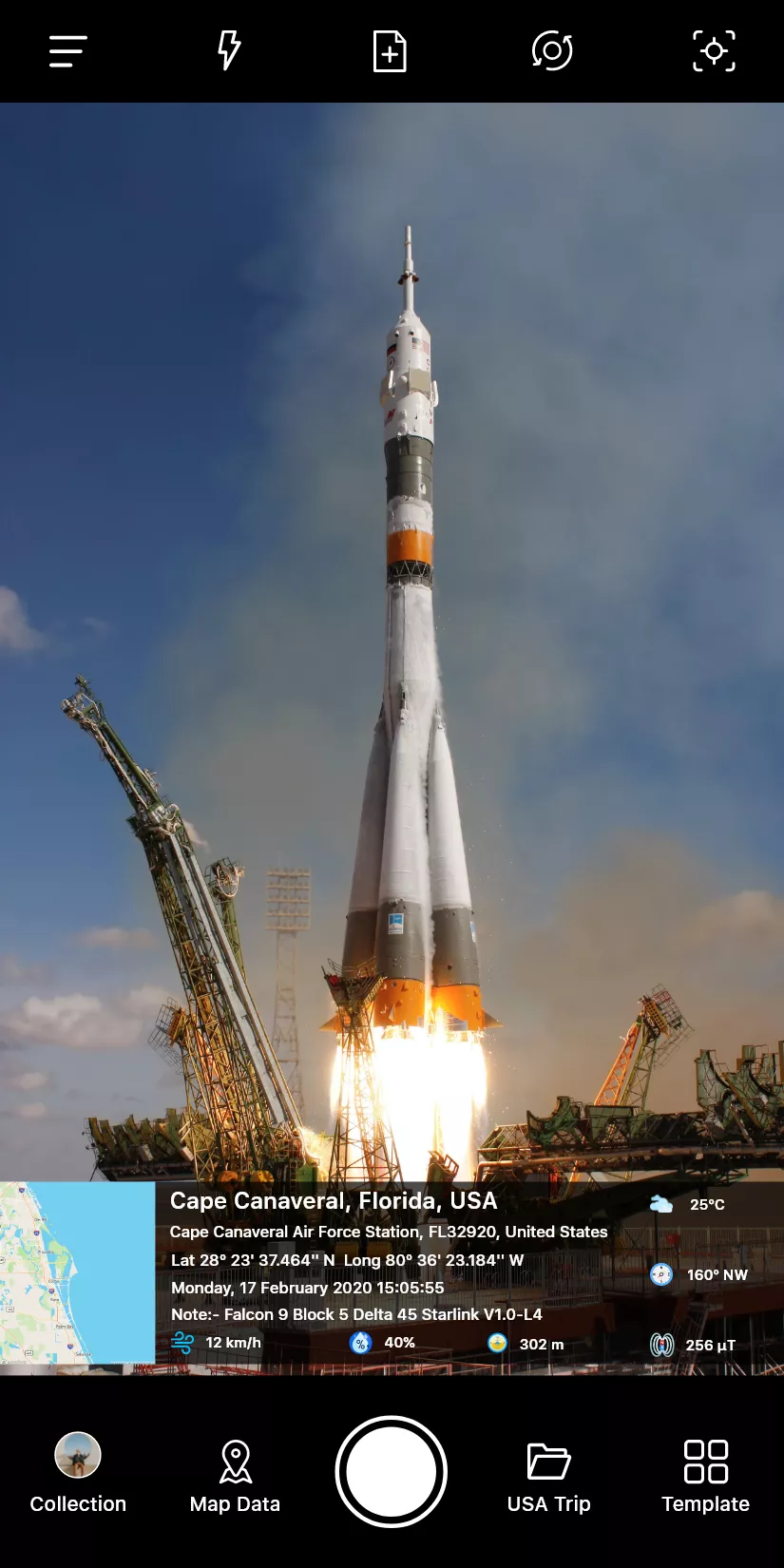
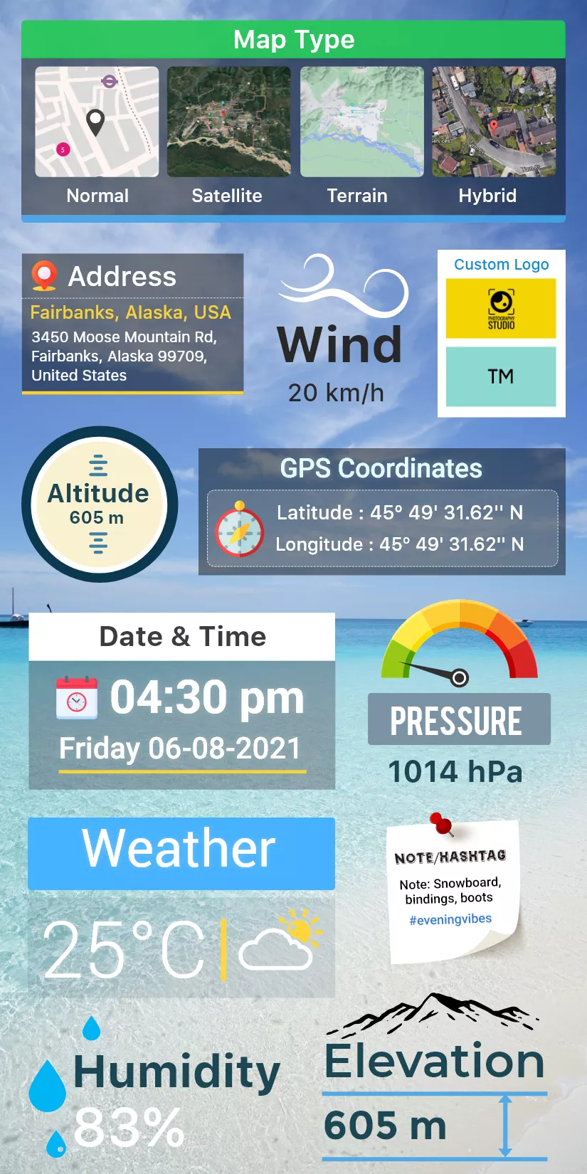
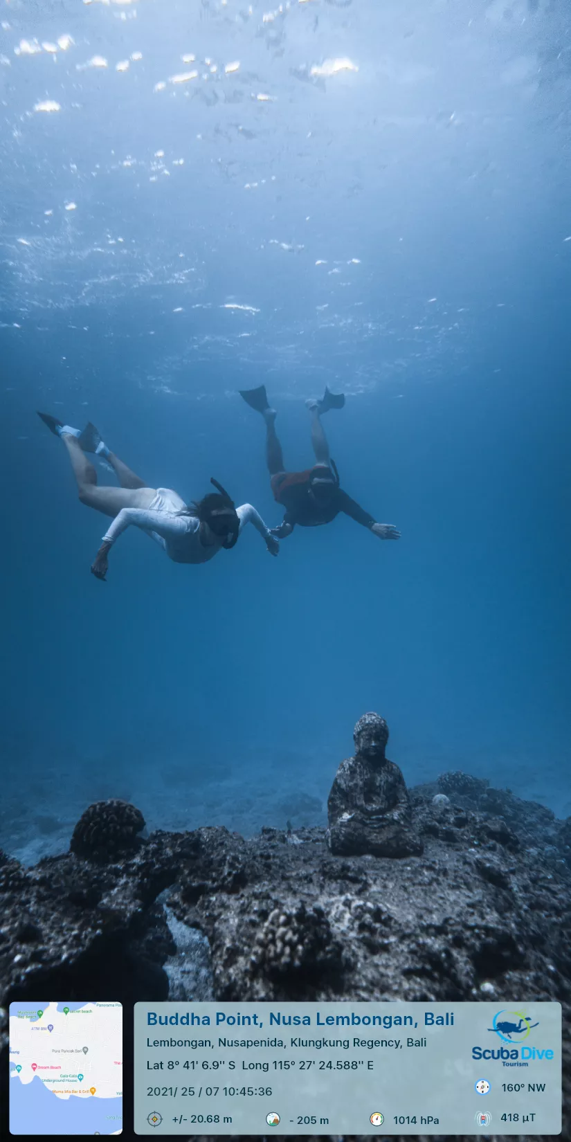
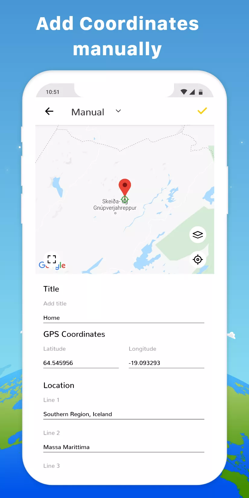
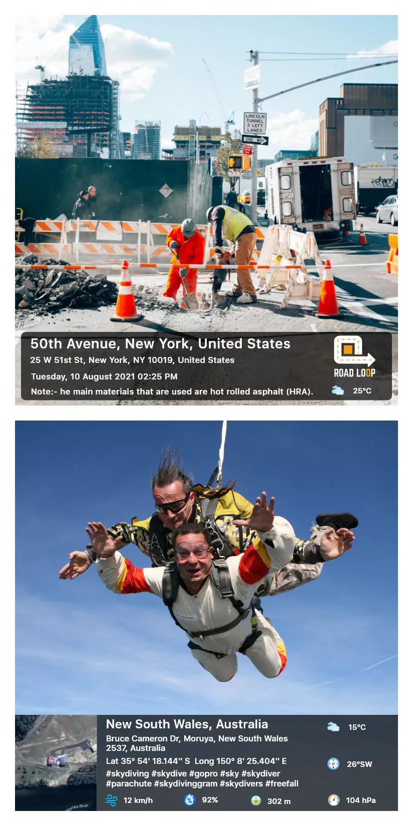
The GPS Map app enhances your photos by adding date/time and geolocation information. They automatically record GPS coordinates on images when you take a photo. This feature is useful for users who want to carefully document their trips, create photo journals, or share travel itineraries with others. The app's user-friendly interface makes it simple and enjoyable to use for any experience level.
Peculiarities
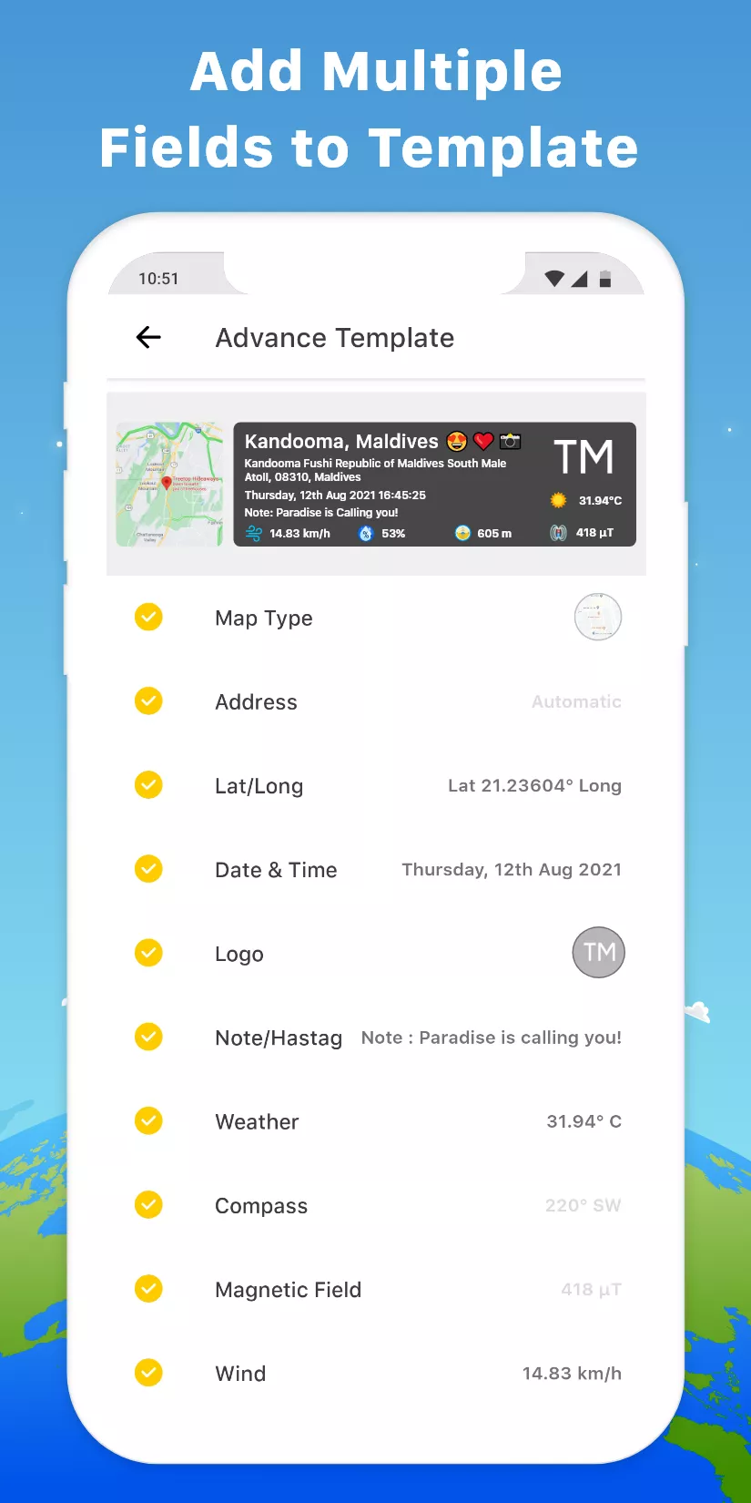
- Adding geotags. Each photo is supplied with GPS coordinates, making it easy to track shooting locations.
- Date and time. The exact date and time of shooting is displayed on the photo, which helps in creating historical reports.
- Signatures. Ability to add custom captions and notes to photos for a more detailed description.
- Integration with maps. The app allows you to view photos on a map, giving you a clear idea of your route.